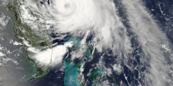
Hurricane Arthur's Cloud-Covered Eye
When NASA's Aqua satellite passed over Tropical Storm Arthur on July 2 at 2:50 PM EDT on July 2nd, it saw a cloud-covered eye as the storm was on the way to becoming a hurricane.
This visible image of Tropical Storm Arthur was captured by the Moderate Resolution Imaging Spectroradiometer or MODIS instrument that flies aboard NASA's Aqua satellite. Arthur's center was over the Atlantic Ocean and east of Florida's northeast coast.
By 5 AM EDT on July 3, Arthur's eye had formed but remained cloud covered even as the storm hit hurricane-strength with maximum sustained winds near 75 MPH.…