Geology

Article teaser image
Spanning 40 degrees of latitude, some 4,800 kilometres (2,980 mi), the Rocky Mountains run the length of North America from the Liard Plain in the north to the Rio Grande in New Mexico. The river systems that gather and wind their way out of these mountains head in all directions. Vertically, they soar above 14,440 feet (4,401 m). Four individual raindrops hitting their highest peaks could easily end up thousands of miles apart -- one flowing north to the Beaufort Sea, another reaching the the Gulf of Mexico, a third would be absorbed into Hudson Bay to the east and the last into…
Article teaser image
The Earth's mantle, situated under the Earth's crust, is a key area for understanding geological processes but we only come into contact with Earth's circulating layers in the event of earthquakes and volcanic eruptions. It's important to learn more about the characteristics of the Earth's mantle and these characteristics can be portrayed using seismic waves but the techniques used for this purpose still have various shortcomings. Dutch-sponsored research Ebru Bozdag demonstrated this during her doctoral research. Seismic waves are frequently used to image the Earth's mantle. They are…
Article teaser image
Scientists have discovered the presence of a natural deep earth 'pump' that is a crucial element in the formation of ore deposits and earthquakes.  The process, called 'creep cavitation', involves fluid being pumped through pores in deformed rock in mid-crustal sheer zones, which are approximately 15 km below the Earth's surface. The fluid transfer through the middle crust also plays a key role in tectonic plate movement and mantle degassing. The discovery was made by examining one millimeter sized cubes of exposed rock in Alice Springs, which was deformed around 320 million years ago…
Article teaser image
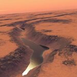
A University of Colorado at Boulder research team say their discovery of shorelines on Mars is an indication of a deep, ancient lake there and a finding with implications for the discovery of past life on the Red Planet. Estimated to be more than 3 billion years old, the lake appears to have covered as much as 80 square miles and was up to 1,500 feet deep, roughly the equivalent of Lake Champlain bordering the United States and Canada, said CU-Boulder Research Associate Gaetano Di Achille, who led the study. The shoreline evidence, found along a broad delta, included a series of alternating…
Article teaser image
Researchers here have used sediment from the deep ocean bottom to reconstruct a record of ancient climate dating back more than 500,000 years.   The data were extracted from  the top 65 feet of a 1,312 foot sediment core drilled in 2005 in the North Atlantic Ocean by the Integrated Ocean Drilling Program. The results provide some new information about the four glacial cycles that occurred during that period.  While climate records from ice cores can show resolutions with individual annual layers, ocean sediment cores are greatly compressed with resolutions sometimes no finer…
Article teaser image
ESA’s Mars Express orbiter has obtained images of Hephaestus Fossae, , which lies at about 21° North and 126° East on Mars. Named after the Greek god of fire, Hephaestus Fossae extends for more than 600 km on the western flank of Elysium Mons in the Utopia Planitia region.  The images have a ground resolution of about 16 m/pixel. They show that the region has channel systems of unknown origin.  The images cover 170 x 80 sq km, an area almost as large as Montenegro. The surface is mostly smooth, and is covered by several small impact craters 800-2800 m in diameter. Smaller…
Article teaser image
Scientists at the University of Leeds say they have uncovered a previously unknown giant volcanic eruption.   And it's no ordinary eruption, they say - it led to global mass extinction 260 million years ago.  The eruption in the Emeishan province of south-west China unleashed around half a million cubic kilometres of lava, covering an area 5 times the size of Wales, and wiping out marine life around the world. Unusually, scientists were able to pinpoint the exact timing of the eruption and directly link it to a mass extinction event in the study published in Science. This is because…
Article teaser image
The Mars rover, Opportunity, surveyed the rim and interior of Victoria Crater on the Red Planet from September 2006 through August 2008. Key findings from that work, reported in the May 22 edition of Science, reinforce and expand what researchers learned from Opportunity's exploration of two smaller craters after landing on Mars in 2004. Opportunity's two-year exploration of Victoria Crater – a half-mile wide and 250 feet deep – yielded a treasury of information about the planet's geologic history and supported previous findings indicating that water once flowed on the planet's surface,…
Article teaser image
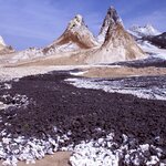
If you didn't know better, you might think the Oldoinyo Lengai volcano in Tanzania was proof of alchemy. There, in the ancient East African Rift at a place known to local Maasai people as the Mountain of God, Oldoinyo Lengai spews forth carbon dioxide-laden lavas called carbonatites. The carbonatites line the volcano's flanks like snowballs.  Oldoinyo Lengai is the only place on Earth where carbonatites currently erupt -- and where carbon dioxide from a volcano doesn't vanish into thin air as a gas. In a paper published this week in the journal Nature, scientists report the results of a…
Article teaser image
An international team of geologists may have uncovered the answer to an age-old question - an ice-age-old question, that is. It appears that Earth's earliest ice age may have been due to the rise of oxygen in Earth's atmosphere, which consumed atmospheric greenhouse gases and chilled the earth. Scientists from the University of Maryland, including post-doctoral fellows Boswell Wing and Sang-Tae Kim, graduate student Margaret Baker, and professors Alan J. Kaufman and James Farquhar, along with colleagues in Germany, South Africa, Canada and the United States, uncovered evidence that the…