Environment

Article teaser image
Oil Spills And Troubled Waters The ongoing environmental disaster in the Gulf of Mexico has much of the anti-environmentalist bloggersphere ducking its collective head beneath the parapet.  Suddenly, America is aware that offshore oil drilling has the potential to wipe out the livelihoods of entire coastal communities.  Perhaps, now, proposals to drill for oil in the Arctic will be examined more closely, and the views of indigenous populations considered more adequately.  If disaster mitigation in the Gulf is difficult, imagine how much more difficult it would be in Arctic…
Article teaser image
Arctic Tipping Points - #6: Are We There Yet? What might cause the Arctic sea ice to have a tipping point? Are we about to reach, or have we already reached a tipping point? This series is a follow-on to my 3-part series Arctic Ice 2010.  The current series began with part #1: Background And Recent History.  In part #2 and part #3 I wrote about various ways in which ice could melt, and how the melt rate might be accelerated.  In Arctic Tipping Points - #4: The Broken Bridges Of Nares I reported the current state of the Nares Polynya as compared with previous years. …
Article teaser image
Interpreting Arctic Satellite Images And Data #2 - AnimationsNow that NASA's MODIS rapid response system is back online I am able to present some animations which I hope you will find interesting. This article is a continuation of Interpreting Arctic Satellite Images And Data. There is a very neat trick which can be used to see if something has changed or moved between two images.  If you can rapidly shift your gaze from one image to the other, blinking in between, the differences appear to jump around.  If a picture is particularly grainy it helps to squint whilst blinking. …
Article teaser image
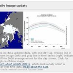
Interpreting Arctic Satellite Images And Data Science writers and media reporters owe a duty of care to their readers: a duty to present facts undistorted by personal opinion or agenda.That duty of care extends not just to what is written, but to what is portrayed in graphs and images. A graphic produced for a specific science-oriented context can be as misleading if taken out of context as any cherry-picked data or quoted words. The graphics and information in the image below are often reproduced without explanation on sites which use such images to back up what they are gleefully reporting…
Article teaser image
Sermeq Kujalleq - Jakobshavn Isbrae RetreatThe Jakobshavn Isbrae, or Jakobshavn glacier, now becoming known by its local name - Sermeq Kujalleq - has been observed retreating since about 1851. Near the small town of Ilulissat, formerly Jakobshavn, Sermeq Kujalleq is the Northern hemisphere's largest glacier with an outlet to the sea.  It drains about 6.5% of Greenland's ice sheet. The ice stream's contribution to sea level rise is about 0.06 millimeters - about 0.002 inches - per year, roughly 4% of the 20th century rate of sea level increase. The calving front of Sermeq Kujalleq is 5 km…
Article teaser image
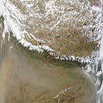
Mountains And Climate When air masses move across mountains they lose moisture.  On the other side of the mountain range you tend to find desert. I thought I'd share this MODIS image which shows the difference in climate zones either side of a mountain range. I'm not naming the range.  Have a guess, and then go to the NASA site for higher resolution images and the location. MODIS/Terra 2010/112 04/22/10 05:15 UTC4km pixel size.image courtesy of NASA Rapidfirehttp://rapidfire.sci.gsfc.nasa.gov/realtime/single.php?2010112/crefl1_14... Edit: a recommended article here on…
Article teaser image
Arctic Tipping Points - #5: Where Warm Water Meets Ice The flows of meltwater and ocean currents in the Arctic make Niagara Falls look like a kitchen tap. This series is a follow-on to my 3-part series Arctic Ice 2010.  The current series began with part #1: Background And Recent History.  In Arctic Tipping Points - #2: Some Feedback Mechanisms and Arctic Tipping Points - #3: More About Feedback I wrote about various ways in which ice could melt, and how the melt rate might be accelerated.  In Arctic Tipping Points - #4: The Broken Bridges Of Nares I reported the current state…
Article teaser image
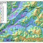
The future effects of global warming could be significantly altered over very small distances by local air movements in complex or mountainous terrain, according to a new paper in the International Journal of Climatology. Based on a regional temperature increase of about 5 degrees projected for western Oregon by 2100, scientists say that some locations, such as mountain ridge tops, could actually increase as much as 14 degrees at some times, while cold air pools in the valleys below them with temperature increases similar to the regional average. "Even if the predictions for average…
Article teaser image
Possibly some of the more hotly contested fishing grounds in the world occur around the Falkland Islands, just off the Atlantic coast of South America. The islands themselves are a point of international contention, and the ocean comes right along for the ride, since fishing accounts for about half of the Falklands' economy. If you're not familiar with it, this history of the Falklands/Maldivas makes for a fascinating read. The short version is that the United Kingdom and Argentina have been fighting over it, and so far the UK has won. As far as the governments of the UK and of the Falkland…
Article teaser image
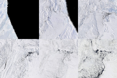
Arctic Tipping Points - #4: The Broken Bridges Of Nares This series is a follow-on to my 3-part series Arctic Ice 2010.  It began with part #1: Background And Recent History.  In Arctic Tipping Points - #2: Some Feedback Mechanisms and Arctic Tipping Points - #3: More About Feedback I wrote about various ways in which ice could melt, and how the melt rate might be accelerated. In this current article I am going to show what is happening in the Nares Strait and Lincoln Sea area North of Greenland.  The ice in that area is showing signs of very early melting and dispersion. The…